A low-bandwidth, open-source web mapping solution enabling rapid localization and deployment for development and humanitarian use.
UN Open GIS Initiative; Geospatial Information Authority of Japan; UN Geospatial Information Section (UNGIS).
Governments, development teams, and humanitarian actors often struggle to publish and maintain web maps in low-bandwidth or disaster-prone environments. Existing solutions are costly to maintain, difficult to localize, and often require specialized vendor support—creating barriers for countries with limited connectivity, budgets, or technical staff.
Smart Maps for Development is a configuration-driven, open-source, white-label web mapping method and template designed for simplicity, flexibility, and reusability. Built on the lightweight principles of the Geospatial Information Authority of Japan (GSI) Maps open-source family, it functions as an independent and generalizable implementation model that can be adapted to a wide range of government and development contexts. Key features include an extremely low bandwidth footprint, compatibility with existing government datasets, OpenStreetMap (OSM), and HDX data, fully configurable text-based layer and UI settings, rapid localization for languages, scripts, and branding, and the ability to operate on minimal infrastructure without vendor lock-in. Its reusable design allows multiple agencies or countries to deploy and maintain public-facing maps quickly and efficiently. By reducing deployment time, technical burden, and cost, Smart Maps for Development expands access to reliable geospatial information for communities with limited connectivity or digital capacity, supporting timely decision-making and enhancing local engagement in mapping initiatives.
Smart Maps for Development removes technical and financial barriers to accessing and sharing vital geospatial information. By enabling localization, supporting various data sources, and requiring minimal infrastructure, it ensures that countries and communities with limited digital capacity can implement modern web maps. This approach benefits vulnerable populations in resource-constrained and disaster-affected areas, fostering inclusive digital development.
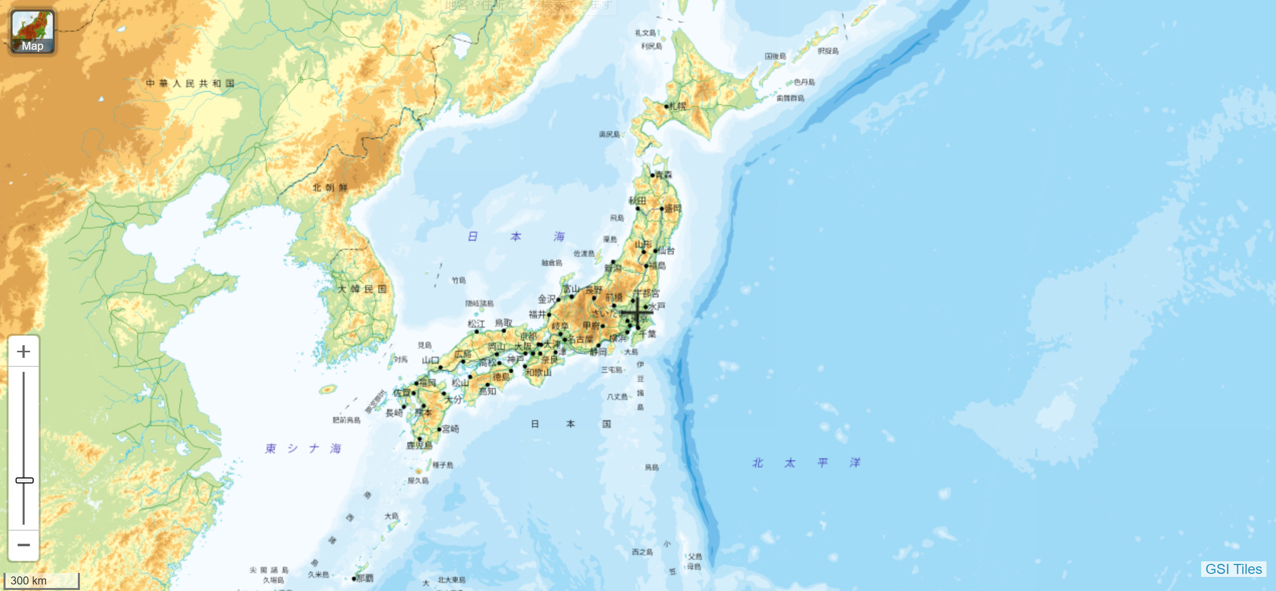
The upstream GSI Maps method, developed by the Geospatial Information Authority of Japan since 2013, has proven to be a stable, low-maintenance, and cost-efficient national geospatial infrastructure, widely used for over a decade and critical in disaster response by quickly providing orthophotos and damage data. Building on this success, Smart Maps for Development generalizes the approach into a reusable model, allowing governments and development partners to rapidly deploy similar public-facing maps without using the original product or external vendors, inspiring multiple open-source tools within the UN Open GIS Initiative and demonstrating broad institutional and ecosystem impact.
Future development of Smart Maps for Development is driven by open-source contributions and adoption by new partners. The open-source nature of the model encourages field-driven improvements and adaptation in diverse contexts.